Größere Kartenansicht
Auf der A39 geht es von Porlock entlang der Exmoor Küste weiter Richtung Atlantik.
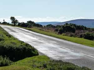
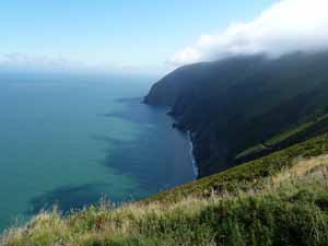
Der Exmoor-Nationalpark ist ein Nationalpark in den englischen Grafschaften Devon und Somerset. Er wurde 1954 gegründet und umfasst eine Fläche von 693 km². Im Norden grenzt er an den Bristol Channel. Die abwechslungsreiche Felsenküste ist durchsetzt mit engen, bewaldeten Taleinschnitten.
Landeinwärts breitet sich hinter einem Randgebiet mit Farmen eine von kleinen Tälern (combes) durchschnittene Hochebene mit Moorheide aus, die nicht selten von Dunst oder Nebel eingehüllt ist. Sie liegt auf einer mittleren Höhe von 300 m; die höchste Erhebung ist der Dunkery Beacon mit 519 m. Exmoor wird von zwei Hügelrücken geteilt. Die Flüsse Barle und Exe fließen nach Süden zum Ärmelkanal, während der Lyn und der Avill nach Norden zum Bristol Channel fließen.
(Quelle: Wikipedia)
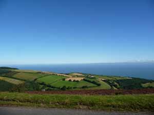
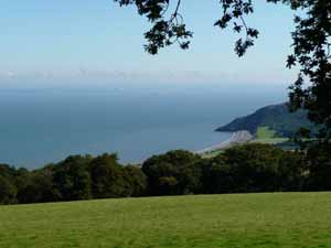 Porlock von oben |
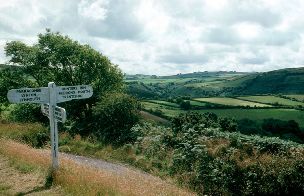 Landschaft im Exmoor-Nationalpark (Wikipedia) |
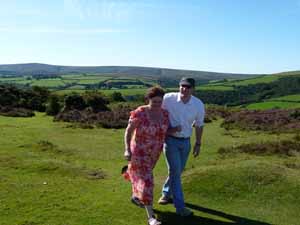
 Ohne Worte... |
|
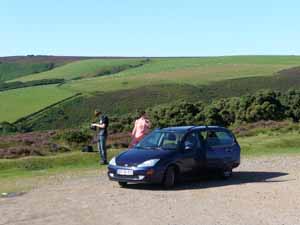 Rast auf einem kleinen Parkplatz... |
 ...im Exmoor-Nationalpark |
Das unbebaute Moorland ist eine offene, baumlose Heidelandschaft, wo Blaubeeren, eine örtliche Delikatesse, und Adlerfarn wachsen. An der Küste kontrastiert rosalila blühendes Heidekraut zu leuchtend gelbem Stechginster.
Ungefähr die Hälfte der etwa 10.500 Einwohner wohnt in den über das Gebiet verteilten Ortschaften, wovon die größten Lynton, Dunster, Porlock und Dulverton sind. Die Kirchen in einigen Dörfern wie Parracombe, Porlock, Culbone und Brendon sind keltischen Heiligen geweiht.
Die landwirtschaftliche Nutzung basiert auf Schaf- und Rinderzucht. Auf den fruchtbaren Böden des Vale of Porlock (Porlocker Tal) und der Gegenden in den Brendon Hills wird auch Ackerbau betrieben. Ein bedeutender Wirtschaftsfaktor in der Region ist der Tourismus. In zahlreichen Orten kann man die Exmoor-Ponys reiten. Dieses wildlebende Moorlandpony ist Großbritanniens älteste Ponyrasse.
(Quelle: Wikipedia)
 |
|
 |
 |
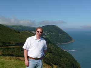 Blick über Lynton & Lyntmouth |

|
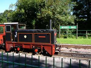
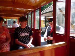
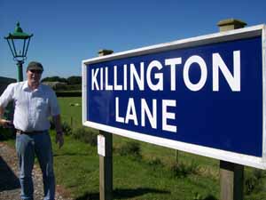
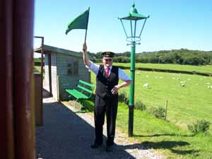
Killington Lane Railway Station
Killington Lane is a temporary terminus about one mile South West of Woody Bay on the Lynton and Barnstaple Railway (L&B), the narrow gauge line that originally ran for 19 miles through Exmoor from Barnstaple to Lynton and Lynmouth in North Devon. The L&B originally opened in 1898, and closed in 1935. Killington Lane opened to passenger services on 27 May 2006, as the rebuilding continues southwards towards the former Halt at Parracombe.
 |
 |
 |
 |
 |
 |
 |
 |
Tarka Trail
The Tarka Trail is a series of footpaths and cyclepaths around north Devon, England that follow the route taken by Tarka the Otter in the book of that name. (Quelle: Wikipedia)
Tarka the Otter: His Joyful Water-Life and Death in the Country of the Two Rivers is a novel by Henry Williamson. The book narrates the experience of an otter. It was first published in 1927. (Quelle: Wikipedia)
Auf unserem Weg machten wir kurz vor Barnstaple Rast beim Tarka Inn.
Größere Kartenansicht
Barnstaple
Barnstaple is a town in the local government district of North Devon in the county of Devon in South West England. It is the main town of the district and claims to be the oldest borough in the United Kingdom. It was founded at the lowest crossing point of the River Taw, about 3 miles (5 km) from the Taw's seafall at the Bristol Channel. By the time of the Domesday Book, Barnstaple had its own mint. Its size and wealth in the Middle Ages was based on it being within the staple, a staple port licensed to export wool, and its importance is still obvious in the town's name. The wool trade was further aided by the town's excellent port, with five ships being sent in 1588 to aid the fight against the Spanish Armada.
(Quelle: Wikipedia)
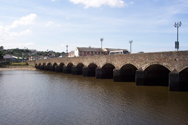 Barnstaple Long Bridge (Wikipedia) |
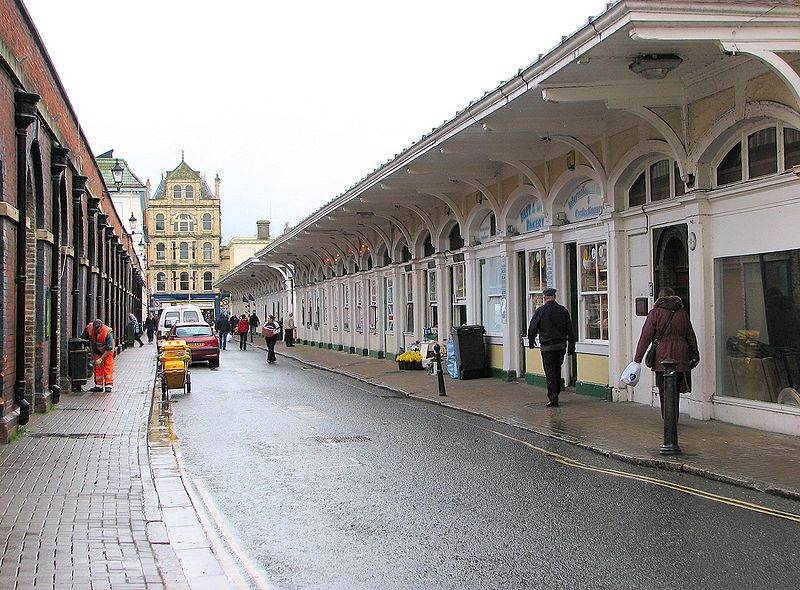 Barnstaple Butchers Row (Wikipedia) |
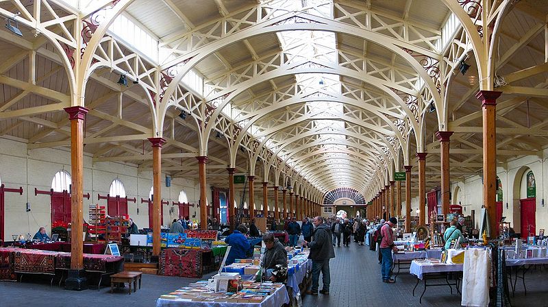 Barnstaple Pannier Market (Wikipedia) |
|
http://www.staynorthdevon.co.uk/site.htm